Let’s make it happen 
3 Likes
Hi! We’re planning to launch an Aerocene Explorer over the Italian Alps (from a location in South Tyrol close to the Austrian border) during the last days of the year. I’ll post more details here soon.
2 Likes
Marco! It would be fantastic! If you can get a hold of a Garmin GPS you can then follow @sasha’s experiments on flight visualization. More info on: From Handheld GPS to Google Earth - A conversation about how to visualize an Aerocene's trajectory
2 Likes
Absolutely! We’re considering to build a simple GPS logger ourselves, but in case we won’t be able due to time constraints we’ll definitely get a Garmin or a similar commercial product—we love the flight visualisations you did with @sasha, and we’d like to make similar ones…
3 Likes
Hi everyone, a quick update about our planned launch in the Alps. We’re looking at forecasts (here: Meteo Trentino Alto Adige nei Prossimi Giorni « 3B Meteo) in order to see what day would be the best for the launch. At the moment the two best options seem to be December 29th and 30th. We’ll keep looking in the next days, when the weather forecasts will be more reliable—and I’ll post here an update with our final decision.
Here’s a a rough schedule for the day of the launch:
- Meet at 9:00am at “Cabinovia Col Raiser”, near Ortisei / Sankt Ulrich (here: Google Maps), which is the starting point of a cableway that will bring us up to 2,000m, near our designated point for the launch;
- Once up there, we’ll have a nice hike in the snow for about 2 hours, in order to reach the small, quite valley where we’re planning the launch;
- We’re building a custom sensor to record the flight path and some athmospheric data;
- Once the launch is done we can decide if we want to go back downhill walking or with the cableway.
The launch is free and we’d love paople to participate! You can contact me here, or write us at folder [at] studiofolder.it for more details and logistics.
2 Likes
This sounds absolutely fantastic.
There is a post about this launch on the Aerocene website too - http://aerocene.org/post/2017/12/aerocene-explorer-in-the-alps-29-30122017
Let me know about and how it goes with the sensor. I’m quite curious, and I don’t think I’m not the only one… ![]()
Hey Marco, hey Elisa,
Very curious to hear more about the launch! How did it go? Did your sensing tracker work? What was it like?
Camilla
1 Like
And here goes a visualization of the amazing Italian Alps flight!
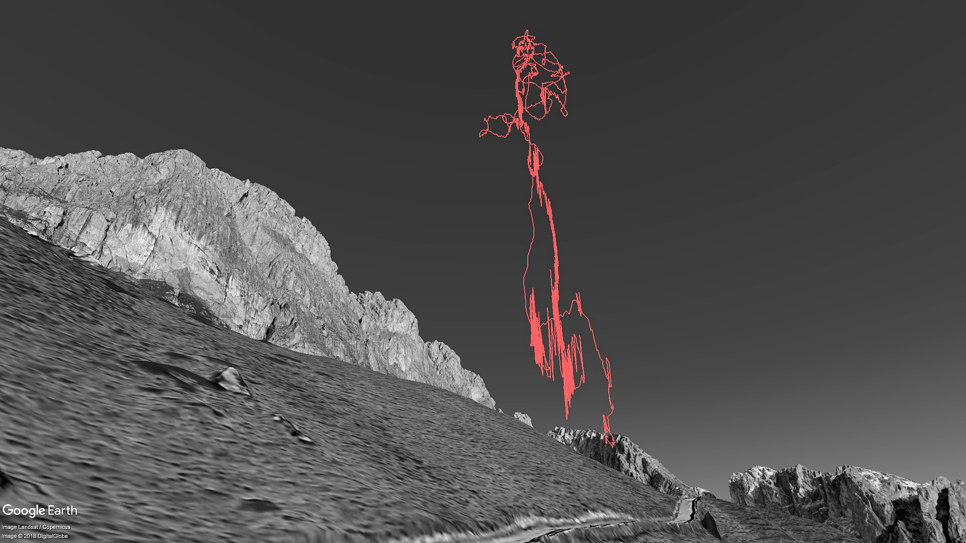
Want to have go on Google Earth yourself? Here’s the flight’s visualization KML file > Alps float.kml (180.4 KB)
2 Likes