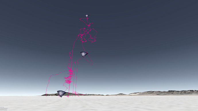
Hi! we’ve made progress in the past week in the field of visualizing Aerocene flights tracking info.
Most significantly:
-
Bill Clark, from EarthPoint.us, has granted the Aerocene Foundation a license to his online coordinates batch conversion tool. No more hassle going from NMEA to Decimal degrees coordinates :))))
-
As most trajectories contain invalid data, it is vital to be able to edit a KML track. For this purpose, I have succesfully experimented with Garmin’s free Basecamp application.
-
Also notable, we can fly past an Aerocene’s balloon flight trajectory using Google Earth’s in-built fligth simulator -let’s not forget to have fun!
https://www.dropbox.com/s/qo8rhm3861a84g5/sobrevuelo%20sensor%20C.mov
before flight
-
check tracker’s battery
-
make sure tracker’s sd card is empty, if not, save the information on to a computer and then empty the card by deleting all files
-
it is worth setting the tracking on for 10 minutes, then retrieving that data an then comparing it to another gps’s data. what are the relationships with the different fields on both files? are coordinates, height and time being stamped likewise on both files?
during flight
- keep a blog (traditional sense of the word, not an online one). make sure you have registered everything related to flight operations. which balloon corresponds to each sensor? for each sensor: time of take off, time of landing. this is vital in order to process flight data and generate signatures in the air
after flight
-
download all flight data from sd cards into corresponding folders. keep everything tidy as much as possible.
-
now that you have your data, it is time to compare the data to the records on your flight day blog: your objetive is to isolate the flight tracking info solely for the time spent by each balloon flying. we will only be using latitude, longitude and height to process the flight trajectory visualization. tools of the trade (free or opensource):
_ LibreOffice for the main editing CSV files > https://es.libreoffice.org
_ TextEdit, NotePad or Sublime text for editing little things, like replacing commas for points, or adding a minus sign
_ Google Earth to visualize the trajectory as a KML file > https://earth.google.com/download-earth.html
_ Garmin BaseCamp to edit the trajectory once you have been able to visualize it > Descargar BaseCamp | Garmin
_ Add your own! -
once you have a CSV file with the flight values, you need to get rid of the unwanted columns such as speed, satellites, just leave latitude, longitude and height.
-
time to convert coordinates from NMEA to decimal degrees. Head to EarthPoint batch convert tool: http://www.earthpoint.us/BatchConvert.aspx. Send me a private message through the forum and I will send you the required login credentials for unlimited batch conversions.
-
it seems you now have the required data! open the file with a text editor and copy all the comma separated values
-
open a previous flight KML file with a text editor, then replace the coordinates with the ones from your recent flight.
-
save, close, and open KML file on Google Earth
We have compiled a lot of interesting screenshots from the process into this PDF file, feel free to check it out: Dropbox - File Deleted
